All new 2014 GalbraithMt.com Smartphone Maps

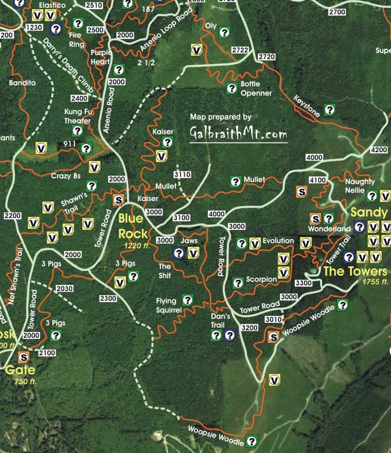
Click here for GalbraithMt.com's all new 2014 Smartphone Trail Maps...


GalbraithMt.com's Ultimate Galbraith Mt. Guide
Click for Galbraith weather & webcams. You must be connected to the Internet...
Editor's Choice Award -
The Kaiser: It Rolls!

Jimmy and Sketch on Kaiser
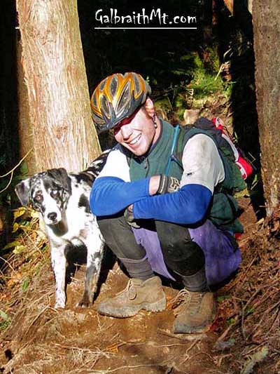
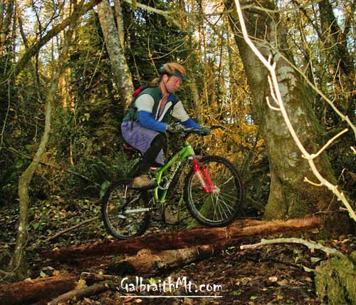
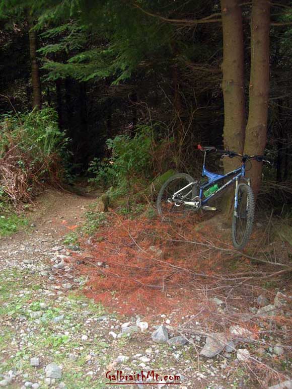
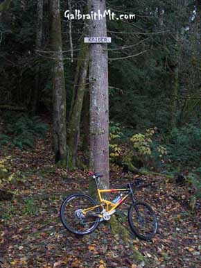
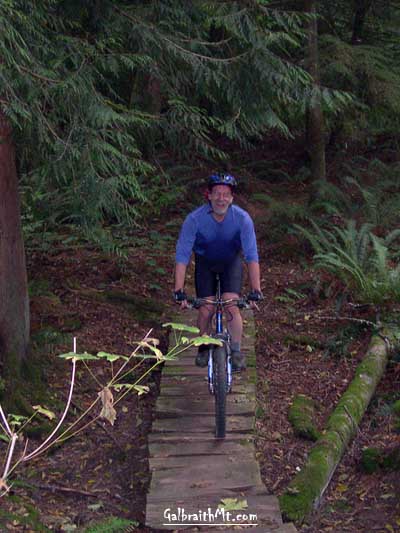
Why are these guys smiling? Because they're somewhere deep in the Kaiser.

ABOVE LEFT -- Mongo rolls a bridge that helpfully spans a wet place.
ABOVE RIGHT -- Jimmy Breitenstein and Sketch take a break.

Trail name: Kaiser
Difficulty rating: Kaiser is a sweet hunk of Galbraith single track, pure and simple, which means the setting is beautiful and the trail is mostly fairly benign. Of course, if you want thrills, you can just ride it faster.
Elevation gain/loss: Negligable
Best riding direction: Rides well both ways
Best seasons: Late spring through late fall; not so good when it's really wet, although it is MUCH better in wet weather now that it was, say, five years ago
Video: Guano riding a bridge he helped build on the Kaiser
Maps:

See trail map at right. Click here for GalbraithMt.com Map Set Index.

Click here for Driving Directions from Interstate 5 to Galbraith, plus MapQuest maps and live WebCam shots of Galbraith and the main freeway exits for Galbraith.

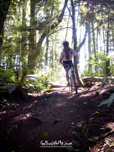
THE KAISER is a real Galbraith throwback. Take the name, for instance. Kaiser was named by Jim Sullivan, the legendary Sully, at the dawn of Galbraith mountain biking, circa 1990.

Jim "Sully" Sullivan at the First Mountain BIke World Championship in Durango, COSully was a novel in the flesh -- a bitingly funny espresso machine repairman who competed at the first Mt. Bike World Championship in Durango, CO, in September 1990. The kitchen table of his home at the corner on Galbraith Lane was Galbraith Central for years.

Sully called this trail, "Kaiser," because "it rolls," and it still does. Appart from the amputation of the northern-most portion by logging in 2002, the Kaiser hasn't changed appreciably since Sully's day.

Talk to anybody who's been riding the mountain for a long time and they get all doey eyed about the Kaiser. My old friend Guano, for instance, used to list Kaiser among his favorite Galbraith trails... before it was destroyed by dirt bikes during the late '90s.

But it's been years now since Trillium's edict against mororcycles, and the benefit of that decision -- in terms of trail quality -- is nowhere more evident that the Kaiser. Although still not the best trail in wet weather, the Kaiser has healed, and it is SWEET, in a Rip Van Winkle sort of way.

UNDERSTAND, there are no big stunts on Kaiser. There aren't even any big climbs. Kaiser is just a trail that snakes through a beautiful mixed conifer / deciduous woods, where pools of sunlight fall amid the dark, farnly shadows. It's not that the Kaiser is a creme puff -- there're lots of up and down and lots of interesting moments along the way, especially if you ride it fast -- it's just that the thing that makes this trail memorable is its mellow, woody setting.

The Kaiser is also a very userful trail. Either Kaiser or lower Mullet (formerly called New Kaiser) can be combined with either Oly or Keystone as an essential link in singletrack routes from the Blue Rock to either Arsenio or the Towers. If you wanna ride trhe road from the Blue Rock to Arsenio, go ahead. But if you want a singletrack route, combine Kaiser / Oly / 187 / Granny's House. Likewise, if you wanna single track route to the Towers, combine Kaiser / Keystone / Naughty Nellie / Wonderland. Sweet!

During the summer of 2006, three giant contemporary Galbraith trail figures -- Guano (who also built Goldilocks & 3 Bears), Legendary David (who also built Kaya) and Mark Belles (who also built Wonderland) put in a ton of volunteer time building bridges, draining bogs, and hauling rock to make what was already a marvelous woodsy excursion into a true gem.

GalbraithMt.com believes the Kaiser and Goldilocks & The Three Bears are currently the best singletrack trails on Galbraith.

Jimmy B (LEFT) rippin' the Kaiser. BTW, those are Mongo's bike and shoes. Although the elevation gain/loss is negligible, there is a lot of rolling up and down on Kaiser (RIGHT).
Roll out the red carpet! Here's what the northern entrance into the Kaiser looked like in autumn 2006 (LEFT). A little tastefull hatching with a chainsaw and some discrete fill with rock have transformed what used to be a killer root crown into a delectible technical morsel for the merely mortal, e.g. Mongo. In the spring of 2005 (RIGHT), there was even a trail sign name on a tree!

Maps    Trails    Technical    Reports    Gallery    Gear    Bikes    Video 


Please read GalbraithMt.com's Terms of Use.

© Copyright 2000-2010 by GalbraithMt.com. All rights reserved.
GalbraithMt.com and astonisher.com are trademarks of BF Communications Inc.

BF Communications Inc.
P.O. Box 393
Sumas, WA 98295 USA
(360) 927-3234

Website by Running Dog


Vert Quest -- excerpts from Mongo's World Record Journal by Bruce Brown
Days: 365 Rides: 220 Total vertical feet climbed: 404,900

Click here for GalbraithMt.com Map Set Index.

Click here for Driving Directions from Interstate 5 to Galbraith, plus MapQuest maps and live WebCam shots of Galbraith and the main freeway exits for Galbraith.