|
|
| R.I.P. -- This Galbraith technicality no longer exists, but we present it here for riders with fond memories, and because you're still likely to encounter this sort of slimey rudeness on Galbraith today. |
|
12 Monkeys:
Gettin' Down The Sweet Way
|
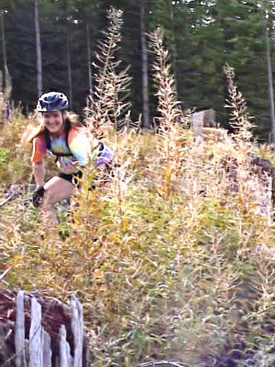
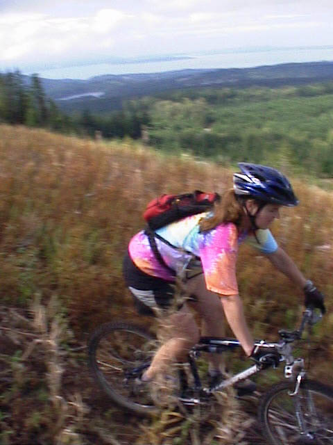
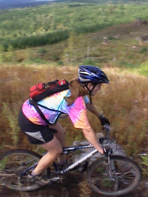
| Julie comes up smiling in the fireweed at the end of a flying dismount on 12 Monkeys just after it comes out of the trees into the clearcut.
|
 |
| Trail name: |
12 Monkeys |
| Difficulty rating: |
built by Carl Shook with help from the legendary Shawn Obra (he of' Shawn's Trail), 12 Monkeys pretty much matches the name. It has a couple technical moments, but the thing you'll probably remember most is the sweeping view of Bellingham Bay and the islands beyond. Further on, Naughty Nellie affords great vistas of Lake Whatcom and Mt. Stuart. |
| Elevation gain/loss: |
500 feet |
| Best riding direction: |
best ridden down from the Towers at the top |
| Best seasons: |
a useful and entertaining trail, it gets heavy use all year long |
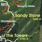
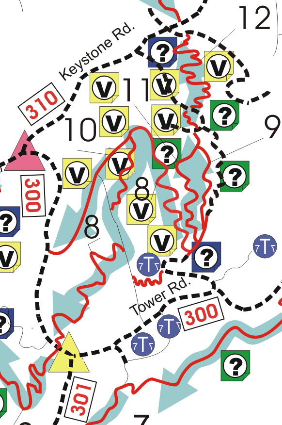
| Maps: |
Click here for trail map. Click here for larger area map. |
TWELVE MONKEYS continues two venerable Galbraith Mt. traditions in one stroke: Galbraith's great tower trail tradition, and Galbraith's great trail name tradition, ala Kung Fu Theater, Evil Twin, Old Issues, Darrell's Death Climb and El Pollo Elastico.
Carl Shook built Twelve Monkeys in 2003 after logging amputated two of Galbraith's great tower trails, the Tower Trail and Wonderland. It helps connect the Towers to Arsenio via Naughty Nellie and Keystone.
If the upper part of 12 Monkeys feels very familiar to experienced Galbraith riders, there's a reason. The entrance to 12 Monkeys is just a few yards from the entrance to the late, lamented Wonderland, and 12 Monkeys follows a very similar course down the ridge, across the forested swale, and up over the next ridge line.
At this point, 12 Monkeys pops out into a new clearcut and becomes another kind of beast altogether. Many riders are almost overcome by the broad, sweeping views of the bay and the islands when they first wheel out into the fireweed. This ridge above Bellingham Bay is fairly exposed to the weather, and so riders frequently find themselves buffeted by wind too. Gotta look sharp, though. There are two big stunts here.
The first is a side hill catwalk that is very reminiscent of the big catwalk on Dan's Trail, in that if you carry sufficient speed into it you can roll right through without ever having to peddle at all. Then there is a section of old growth cedar log, laying lengthways on the steeply plunging slope. If you're fortunate enough to power up onto this log, you have your choice of two lines off -- the hucksters' and the rollers' -- along with a fairly technical "ride around."
That's it for the seriously technical stuff, though. 12 Monkeys is technically demanding (there are some sweet switchbacks and a couple steep pitches to spice things up) but not terrifying. In fact, you might even say 12 Monkeys has a sunny disposition.
And 12 Monkeys is very useful. Together, 12 Monkeys and Naughty Nellie, which follows after a brief section of gravel logging road, connect to venerable Keystone to allow riders to travel via singletrack from the Towers to Kung Fu Theater, Purple Heart, 2 1/2 and Granny's House and the rest of the north side.
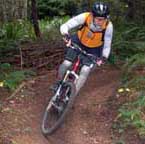
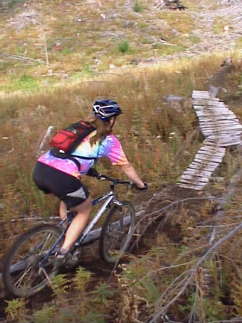
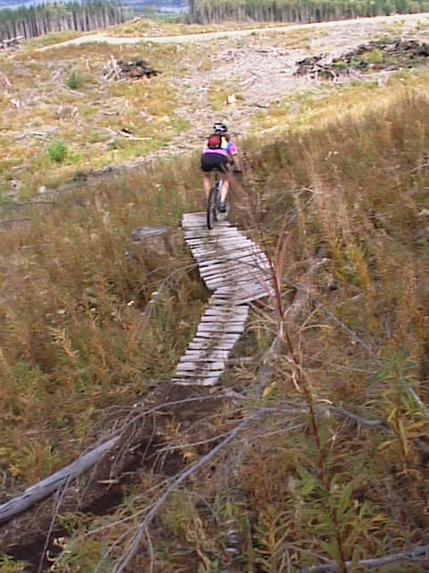
The following are some of the scenes as you descend 12 Monkeys. Click on the thumbnail images to view a larger version...
 |
|
| CLICK PayPal VISA/Mastercard button to buy a one-year online subscription to the Ultimate Galbraith Mt. Guide -- featuring 24 Trail Guides covering 44 trails and including the best, most up-to-date Galbraith Trail Maps ever made -- on GalbraithMt.com for $14.95 complete. Click here for more info... |
| To speak to our Circulation Dept., please call (360) 927-3234 (local call in the Bellingham, WA area). |
|
|
Please read GalbraithMt.com's Terms of Use.
© Copyright 2000-2010 by GalbraithMt.com. All rights reserved.
GalbraithMt.com is a trademark of BF Communications Inc.
BF Communications Inc.
P.O. Box 393
Sumas, WA 98295 USA
(360) 927-3234
Website by Running Dog 
|
 
|
|


 You don't have to get lost. You don't have to ride the same couple trails over and over again.