All new 2014 GalbraithMt.com Smartphone Maps

Click here for GalbraithMt.com's all new 2014 Smartphone Trail Maps...


GalbraithMt.com's Ultimate Galbraith Mt. Guide
Click for Galbraith weather & webcams. You must be connected to the Internet...

Wonderland: A Great New/Old Trail

Russ Barlow gets big air at Sandy Stone, which has become a major Mecca for hucksters. Barlow was first person who spotted the big air possibilities at Sandy Stone, and the first person to successfully land this signature Galbraith stunt.

Trail name: Wonderland
Difficulty rating: Despite being destroyed by logging in 2003, Wonderland is again a sweet trail that can be ridden either way. There are some interesting technical moments along the side of the trail -- including the fabled Sandy Stone -- but if you stay on the trail it's intermediate all the way
Elevation gain/loss: 75 feet
Best riding direction: Either down from the Towers, or as a the last part of the only single track ascent to The Towers at the top
Best seasons: Provides good riding all year 'round
Maps:

See trail map at right. Click here for GalbraithMt.com Map Set Index.

Click here for Driving Directions from Interstate 5 to Galbraith, plus MapQuest maps and live WebCam shots of Galbraith and the main freeway exits for Galbraith.

ONE DAY in 2000, a maintenance truck encountered a lone mountain biker peddling up the Tower Road on Galbraith Mt.

Great Galbraith Mt. Riders: Mark Belles on Dan's Trail by MongoThe guys in the truck were used to this -- they had seen countless mountain bikers -- but they had never seen anything quite like the apparition on the road ahead of them now.

The solitary rider had a small trailer attached to the back of his mountain bike, where nearly 65 pounds of concrete blocks were stacked.

"Boy you're a glutton for punishment," one of the maintenance crew guys chuckled out the window as the truck drew close.

"Actually, I'm going to use the concrete blocks on a trail I'm building," the rider replied cheerfully. "I want to try to use them to control erosion on a steep section."

Thus was born the trail called Wonderland, and the insto-legend of Wonderland as well.

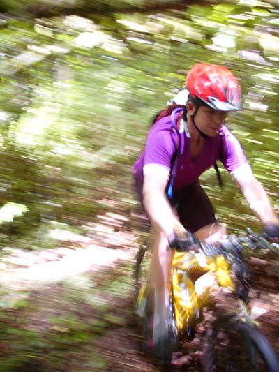
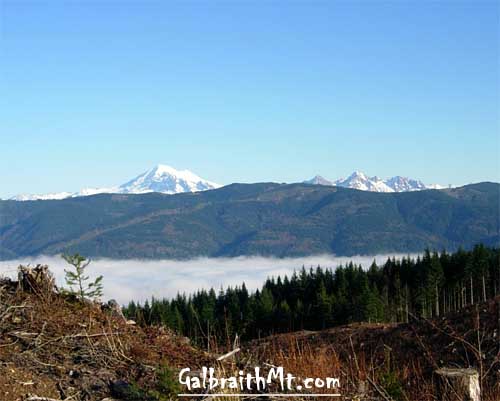
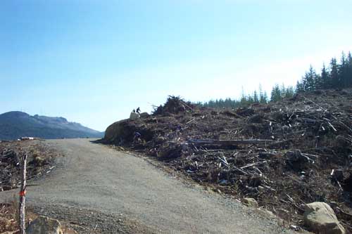
OPENED IN May 2000, Wonderland quickly became the preferred route down from the Towers for many riders until it was destroyed by logging in 2003, along with two nearby trails, the old Tower Trail and the Polaski.

Legendary Galbraith trail builder Darren Clark on Galbraith Lane in Bellingham, WABut Wonderland did not die! In 2004, the WHIMPs' volunteer trail crew headed by legendary Galbraith trail builders Darren Clark (LEFT) and Scott Fleenor rebuilt the trail. The new Wonderland doesn't follow exactly the same line, but it's very close to the original Wonderland, and it has very much the same flavor and spirit.

Belles's original Wonderland had some technical moments, but it was not a super technical chamber of horrors. When he laid out the original line, Belles consciously tried to create a trail "that could be ridden and enjoyed by most mountain bikers, not just the top five percent."

Darren and Scott stayed true to this aim, and even took it a step farther. The new Wonderland can ridden both ways! Combined with Naughty Nellie, Wonderland provides a single track ascent all the way to the summit and the Towers. It also rides very well the other way too!

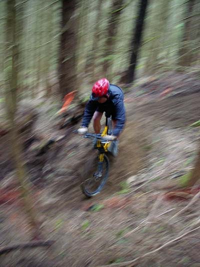
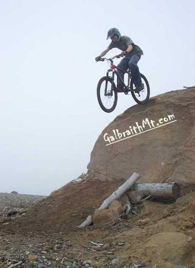
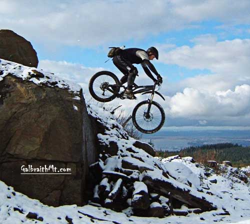
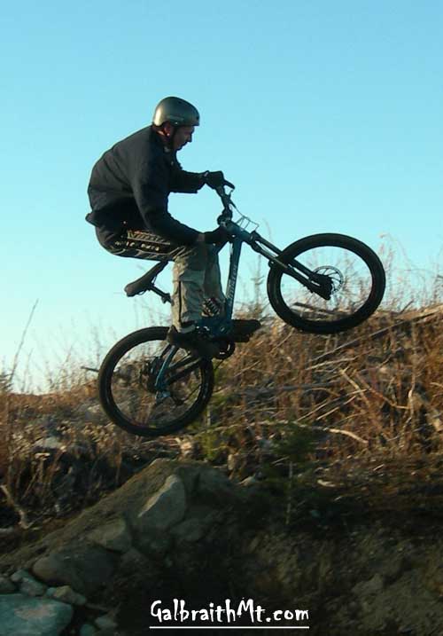
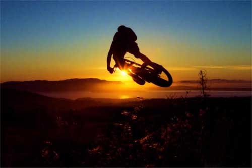
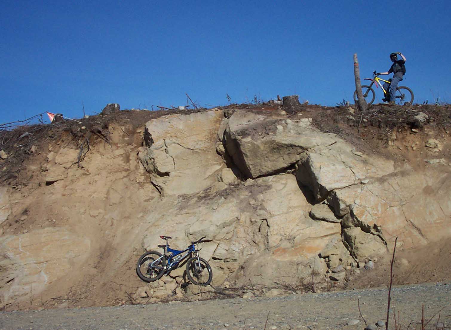
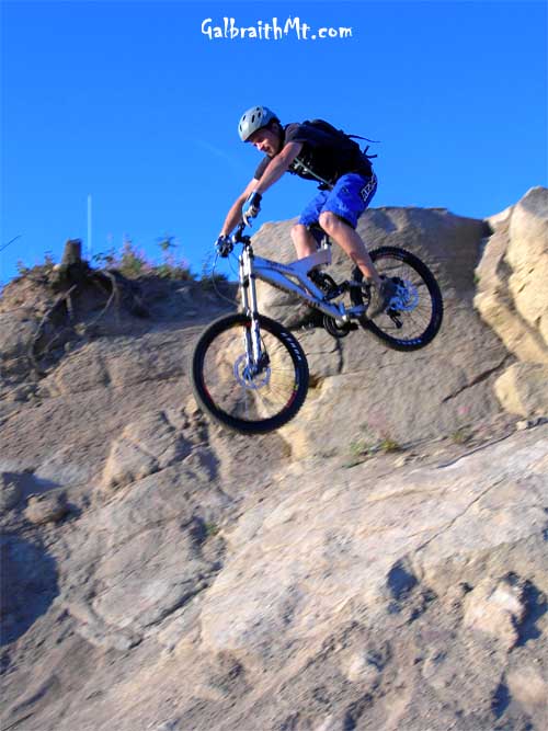
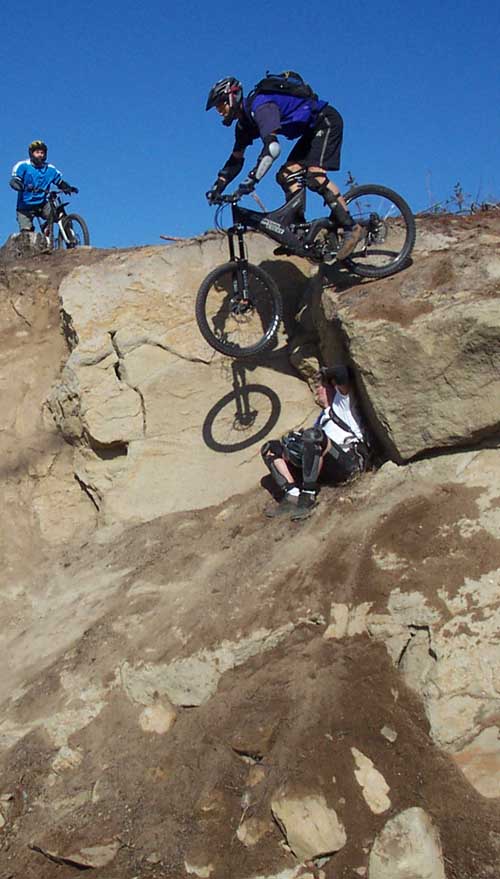
But Wonderland has its dark side too. The Sandy Stone on Wonderland -- created by a road cut for the logging that trashed the lower part of the original trail in 2003 -- is one of the deepest and most popular big drops on the mountain, and the stunt complex around it has grown steadily. There are now several drops, hip jumps, and a few rolling wall lines thrown in for good measure.

Great Galbraith Mt. Riders: Russ Barlow at Sandy Stone by Mongo
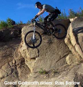
Discovered by Russ Barlow -- who was also the first man to hit the big drop there -- Sandy Stone Most riders just look with awe, though, and then easily ride around all the hideously scary stuff on Wonderland. This is worth noting. You don't have to ride any of this stuff if you don't want to. Of course, some of the ride-arounds on Wonderland are interesting in themselves.

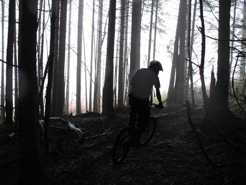
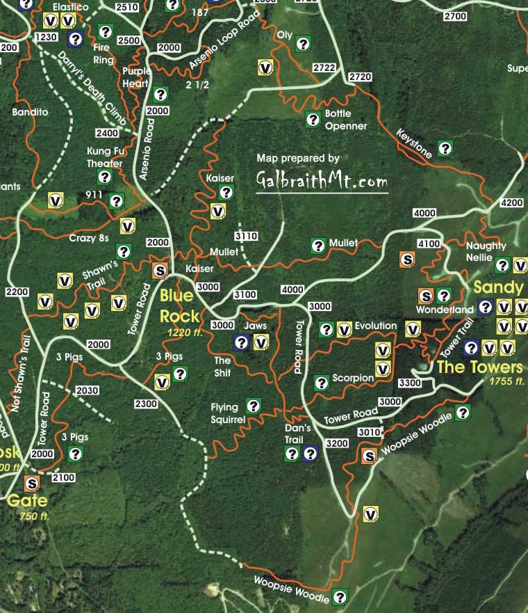
There is presently a trail sign near the top of Wonderland, but it's nailed to a tree in the woods at the bottom of the first drop off the ridge line, so you have to know where to look to find the start of the trail. Here's the secret: Wonderland is the third trail on the left after the Tower Rd. turns into single track and drops over the roots.

Here's another tip: if you're coming down through the woods, and you come to a huge old growth cedar log lying prone on the forest floor, you're on the wrong trail. You're on Scorpion, not Wonderland. Climb back up the way you came until you can take a trail out of the woods heading the other way, where you'll soon see Lake Whatcome below (if you're lucky).

Click on the thumbnail images to view a larger version...


Belles in Wonderland: Mark Belles, creator of the original Wonderland, letting it rip in the woods near the top of Wonderland...
mb_062700.jpg (70019 bytes) Here Belles slices a steep, rooty pitch off the ridge line the way it was in the beginning....
mb5a_051700.jpg (39954 bytes) And here snaking around the tight, cinder-block reinforced switchback that was a signature of the original Wonderland....
Too soon now, though, you come out of the trees into a big clearcut. Here GalbraithMt.com Buzz forum member IBrake4Cliffs approaches the edge of the trees in fog....
Here's Mongo on the fly a little further down after the trail leaves the woods and enters a large clearcut. That's Lake Whatcom in the distance. (Photo by David Waugh)...
Which affords stunning views in every direction. Here's Mark Adriance with Mt. Baker and Lake Whatcom in the background...
A closer look at Mt. Baker and the Sisters, as seen from Wonderland, courtesy of GalbraithMt.com Buzz member BigHoss....
A panorama by Sean Doan looking the other way, toward Bellingham Bay, from upper Wonderland. This pic was taken in November after a light snow...
Part way down, Wonderland is bisected twice by loggng roads. Here two riders are about to make their descent to the first road. Each time, the trail picks up on the other side...
Here's the view off the lip of the Small Wall on Wonderland, looking Northwest toward King Mt., which is floating above the fog on the far side of Bellingham, again courtesy of BigHoss. And here's another panorama showing the view the other way, looking at Galbraith from King Mt...
An alternate exit to the road is this rock wall gap jump, here demonstrated by David Waugh...
Here's Russ Barlow hucking the same stunt in the snow, this time viewed looking the other way toward Bellingham Bay in the distance (Photo by Jason Weirach)...
Next comes a tasty hip jump across the road where the trail resumes, demonstrated by Russ Barlow...
Here's Ryan "Sweet Nutbar Move" the Ripper taking flight off the left hip jump into a brisk headwind...
And Jason Weirauch -- AKA Jdub -- airing out the right hip at Sandy Stone...
Double hip jump! In November 2005. Here are Ryan the Ripper and Russ Barlow taking simultaneous flight off the right and left hips. (Photo by Jason Weirach)...
Oh yea! Chris Luna launches the hip jump at sunset in this stunning pic by Cartman83...
And now the fabled Wonderwall. Here's the view past Wonderwall on Wonderland, with Bellingham in the blue distance...
Ladies & gentlemen, I give you the Rock Wall on Wonderland, AKA the Rock Ledge or Wonderwall. Click here for GalbraithMt.com's Technical Note on Wonderwall...
Here's the view down to the rod from the take off on the Sandy Stone...
Here Jason launches the flying line with the greatest of ease...
sh1_110700.jpg (32622 bytes) And here legendary Galbraith trail builder Dan Waters launches it, while Kevin Unruh (above) and Jeff Cobb (below) look on...
There are several tasty stunts on the last part of Wonderland as well, if you're inclined toward that sort of thing. Here's Galen O'Moore acing one of them -- a snow covered log ride -- on a crisp day in late November. The main trail is on Galens's left.

Maps    Trails    Technical    Reports    Gallery    Gear    Bikes    Video 


Please read GalbraithMt.com's Terms of Use.

© Copyright 2000-2010 by GalbraithMt.com. All rights reserved.
GalbraithMt.com and astonisher.com are trademarks of BF Communications Inc.

BF Communications Inc.
P.O. Box 393
Sumas, WA 98295 USA
(360) 927-3234

Website by Running Dog


Vert Quest -- excerpts from Mongo's World Record Journal by Bruce Brown
Days: 365 Rides: 220 Total vertical feet climbed: 404,900

Click here for GalbraithMt.com Map Set Index.

Click here for Driving Directions from Interstate 5 to Galbraith, plus MapQuest maps and live WebCam shots of Galbraith and the main freeway exits for Galbraith.