Click here for GalbraithMt.com's all new 2014 Smartphone Trail Maps...
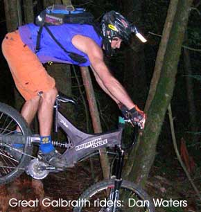
Dan Waters Strikes Again
|
|||||||||||||||||||||||||||||||||||||||
|
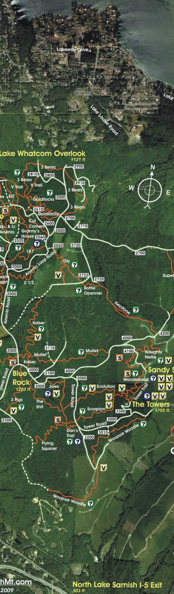
DAN WATER'S New Trail -- AKA Dan's Trail or Dan's Secret Trail -- is probably the worst kept secret on Galbraith Mt.
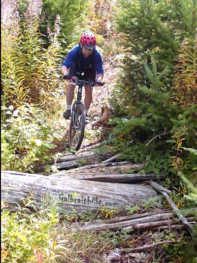
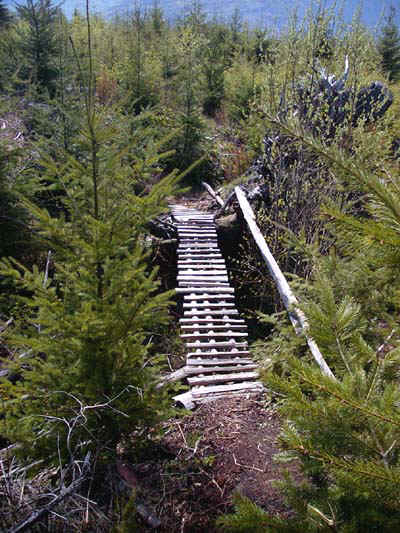
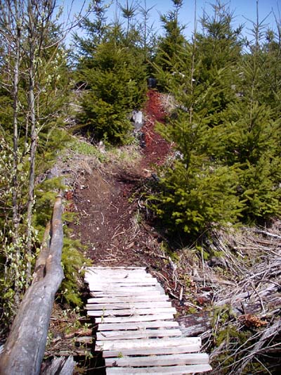
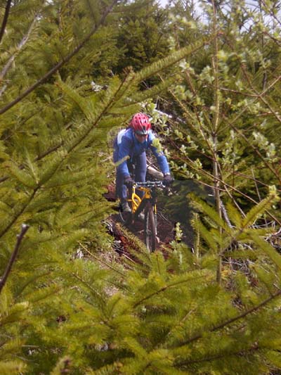
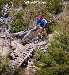
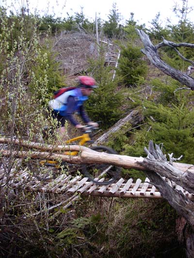
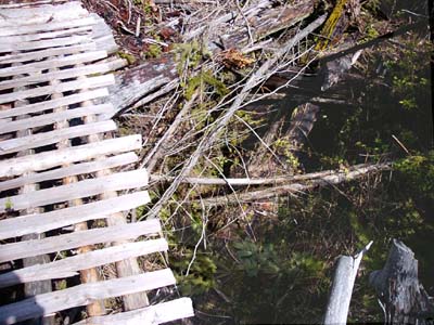
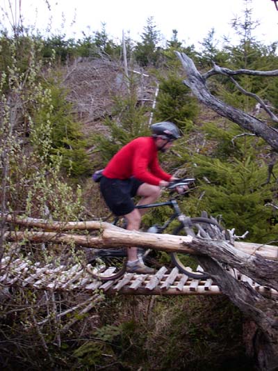
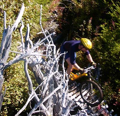
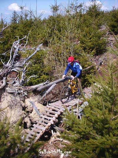
This is partly due to its spicy gumbo of steep pitches and deep log drops, but the centerpiece of the trail -- and the thing that has given it notoriety -- is its high catwalk / old growth cedar log crossing. Some nifty log drops set up a plunge down a very steep pitch covered with soft red cedar -- wham -- onto the beginning of the catwalk, which you climb to its narrowing apex, before falling away and power s-ing around a hug old grow stump and out across an old growth cedar to the other side of the ravine. PLEASE NOTE, however, as of the fall of 2004, many experienced Galbraith riders no longer trust the catwalk pictured above. They usually choose the detour on the right. The catwalk's still there, though. So you can check it out and decide for yourself. Either way, Dan's is a lot of technical fun. The log rollovers in the last section, which have a sort of crescendo effect leading up to the Bad Boy, who is still being fairly bad. Mongo once broke his helmet endo'ing here.
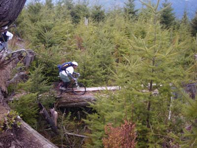
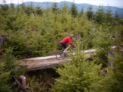
In fact, you can rip Galbraith almost entirely on singletrack by climbing the Tower Rd. to just short of the top where you pick up the Woopsie Woodle. Then you descend the Woodle to mid-point (sweet!), climb the 301 Rd. to the Yellow Superman Rock, and link that to descend Dan's Trail to The Flying Squirrel and the Three Little Pigs. If you don't want to go down to the bottom of the mountain just then, Dan's Trail also connects to another Dan Waters's creation, the Jaws of Death, AKA Jaws, which begins with another of Dan's stunts, the Jaw Walk. Jaws is very short and very extreme, with a really heinous drop into the creek and yet another narrow slatted rampway to deliver you to the seriously steep climb out (that's so Galbraith). You may notice the cave-like lower end of it on the right as you climb the road to the Towers, but it's best ridden the other way, starting at the Jaw Walk The following are some of the scenes as you descend the high catwalk / old growth log crossing combo. Click on the thumbnail images to view a larger version...
|
Click here for GalbraithMt.com Map Set Index. Click here for Driving Directions from Interstate 5 to Galbraith, plus MapQuest maps and live WebCam shots of Galbraith and the main freeway exits for Galbraith. |
||||||||||||||||||||||||||||||||||||||


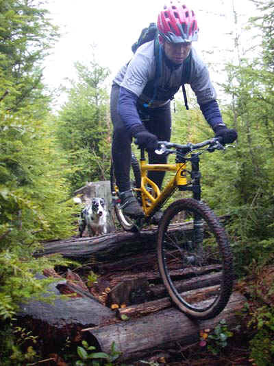
 Despite the fact that the entrance from the Tower Rd. is blocked by a goodly sized slash pile and unmarked in any way, this gem has been getting a lot of attention.