|
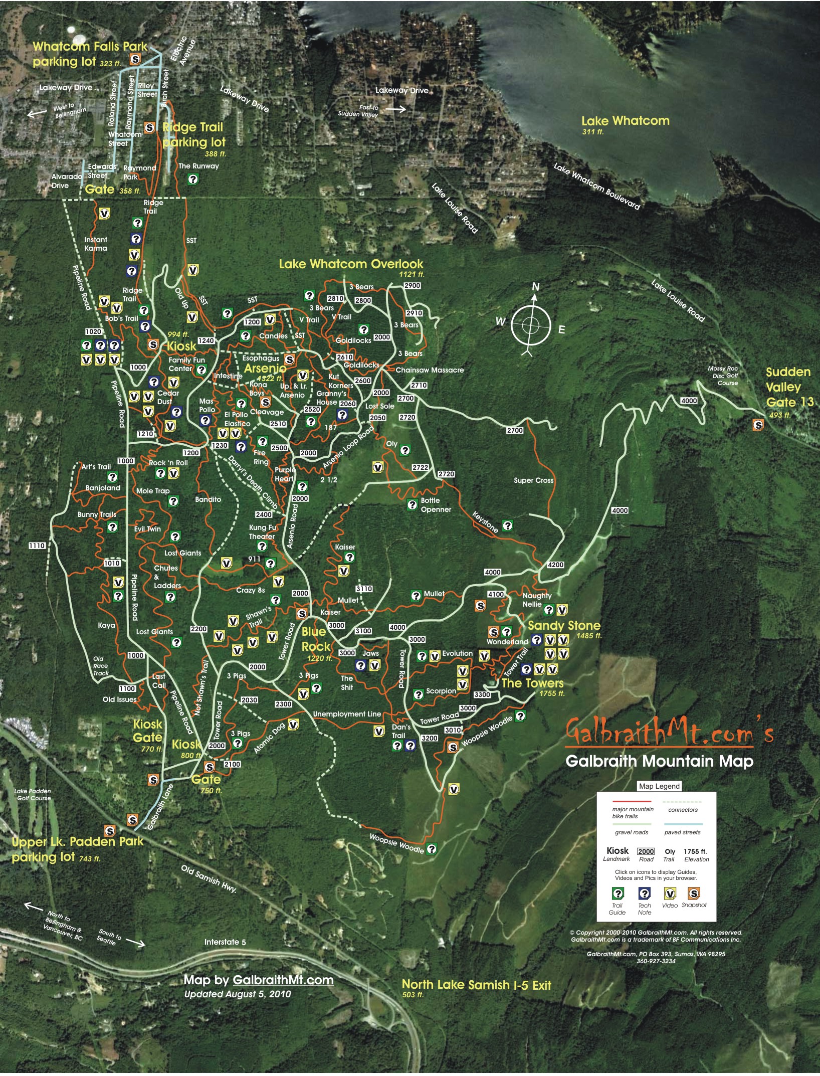
HERE'S THE BIG BELLS and whistles version of the GalbtraithMt.com Trail Map, with Hot Links to all our Trail Guides, Technical Notes and Video Clips. You can use this version online to really get to know the mountain.
Here's how it works. To view Video Clips for a particular trail, you just click the yellow V icons located by that trail on the map. And to open the Trail and Technical Guides, you just click the green and blue ? icons., etc. Try it. Pretty wicked to see Dave Sears air out the Big Huck on Lower Bob's, isn't it?
Click here for the big basic version of the map, which is great when all you want to see is the mountain and the trails -- naked, so to speak.
Click here for the compact printable version of the map, which prints on a single 8 1/2 x 11 sheet of paper. Print this map out, and take it with you on the trail. And if it gets trashed, just print another!
Happy trails...
-- Mongo
August 30, 2009
Updated August 5, 2010
NOTE: Because of the extensive logging on Galbraith over the last several years, these maps are no longer accurate. Most of the trails still exist, but many have different routes and connect in different places.
|