Click here for GalbraithMt.com's all new 2014 Smartphone Trail Maps...
Evolution: The Shape of the Future |
|||||||||||||||||||||||||||||||||||||||||


| Trail name: | Evolution |
| Difficulty rating: | Double black diamond -- this is one of the most stunty and jumpy trails on Galbraith, and it is joined at the hip with another Galbraith's most extreme trails, The Scorpion. For the freeride folks, this is the payoff for climbing all the way to The Towers. |
| Elevation gain/loss: | 200 feet |
| Best riding direction: | Down |
| Best seasons: | Gets heavy traffic all year 'round |
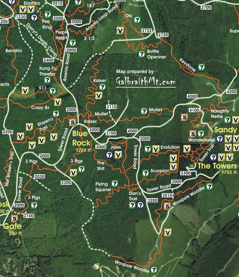
| Maps: |
See trail map at right. Click here for GalbraithMt.com Map Set Index. Click here for Driving Directions from Interstate 5 to Galbraith, plus MapQuest maps and live WebCam shots of Galbraith and the main freeway exits for Galbraith. |
|
THE TRAIL WE call Evolution was originally just an alternate line to The Scorpion which intertwined across the shoulder of the mountain like some sort of intricate tatoo.
If you find yourself on Dan Waters's fabled Stinger, you're at least temporarily on the old, original Upper Scorpion (although much modified). However, many of the swooping, bermed tirns and built-up jumps in the favored freeride line above and below The Stinger are actually Evolution, properly speaking. The whole Upper Scorpion, Upper Evolution, Upper Wonderland area can be a confusing place, but here's the deal. You're basically offered a series of left and right forks. If you take the first right you end up on Wonderland, and if you take the second right and you end up on the remnant of an old abandoned trail called 12 Monkeys. You don't want those. You want to go either straight or to the left. If you take the first left after you drop off the ridge line, and you'll get a sweet set of bermed corners leading to the Stinger. Go straight and you'll roll over the shoulder of the ridge and come to the Stinger via some very gnarly drops. This is the old, original Scorpion line, the one Dan Waters's is shown riding in the pic at the top of GalbraithMt.com's Scorpion Trail Guide.
When you get to the old cat track that cuts across both trails, it gets even more confusing (sorry), which is to say completely counter-intuitive. Go left along the cat track a ways and you can drop into the old lower Scorpion, with its signature log ride and suspension bridge (yea, that's right, suspension bride!). Go right at the cat track and you can drop into lower Evolution, with it's rollicking jumps. In 2009, many riders ride the combined Upper Scorpion / Upper Evolution (The Stinger plus the big bermed turns and jumps), then head to the right to take oxygen on Lower Evolution, which terminates on the Tower Rd.
Of course, if you come down Lower Evolution, you've got to ride a hundred yards of flat gravel road (Oh, no!) -- the Tower Rd. / 3000 Rd. -- to get to the top of Flying Squirrel (called Luge by the freeriders), which meets the bottom of Scorpion. However, Evolution had now been extended across the 3000 Rd. to connect with the remnant stub of Dan's Trail, Flying Squirrel and The Shit, the last of which spits the rider out at the bottom of Darryl's Death Climb, where you can connect to Cedar Dust or Mas Pollo. The following are some secenes from along the trail, from top to bottom. Click on the thumbnail images to view a larger version... |
 Not surprisingly, it's just about impossible to tell Upper Evolution and Upper Scorpion apart these days without a DNA sample and extensive lab tests. The two are pretty inextricably intertwined in an elaborate stunt playground until they hit the cat track, and go their separate ways to Lower Scorpion (left) and Lower Evolution (right).
 |
There are several drop ins from from The Towers and the old Tower Trail to Scorpion, Evolution and Wonderland.
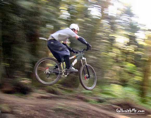
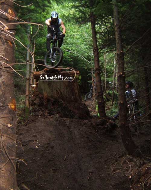
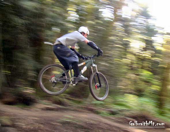
Here David Waugh flashes through the dark woods just below the Towers.... |
 |
After the initial drop off the ridge line at The Towers, you come to a ghosty forest where the line unravels into a maze of competing lines, many of them stunted. If you go left into banked and bermed turns that leds to a long log ride on an old growth cedar, you're on Upper Scorpion.
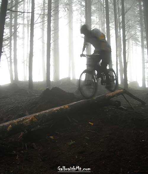
If you follow the wandering line over the shoulder of the mountain and down the steep face that follows, you're on Upper Evolution. This skinny was built on Upper Evolution by volunteers during early 2006. Here's GORGANZOLA in the drifting fog (snow too!) at the very top of the skinny... |
 |
And here's a long view of the skinny, looking back at a rider just starting the skinny from about the mid-pont...... |
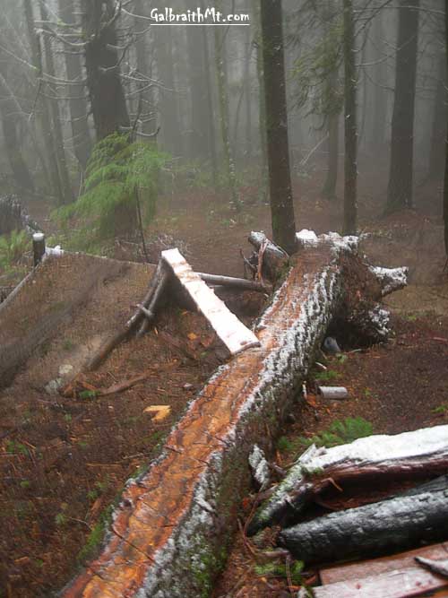 |
And finally here's the exit, which offers you a couple choices, both flying: off the end of the log at right, or off the plank skinny to the left... |
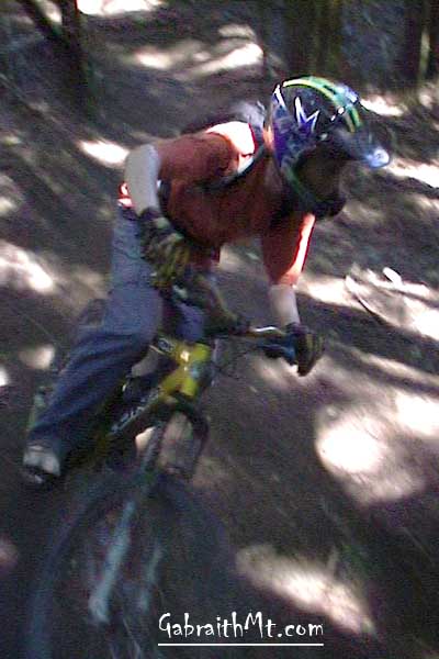 |
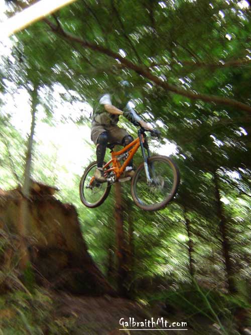
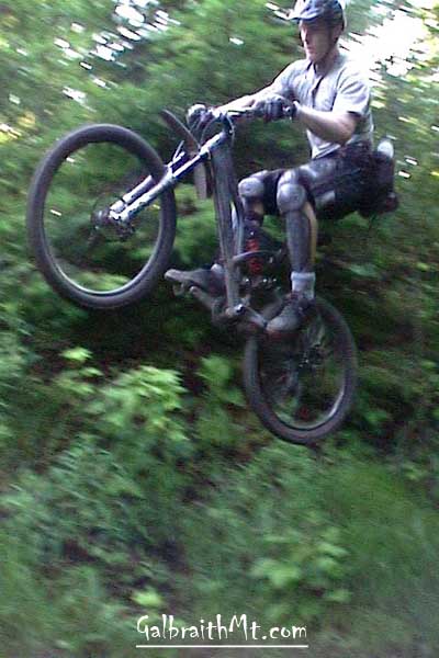
A super sweet section of bermed turns follows. David Waugh swoops to the left on his signature gold Kona Stinky... |
 |
And then to the right in a turn which leads quickly to the Stinger. Here's video of David Waugh flying through the bermed S turns... |
 |
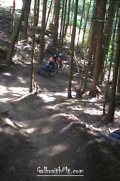
Further down, near the top of Lower Evolution, Ryantheripper shows how in this new Freeride spur zone... |
 |
While GORGANZOLA goes right at it... |
 |
And Adam of Hiddenwave styles... |
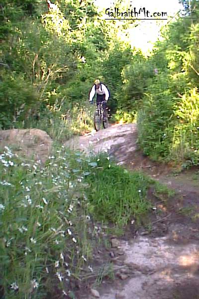 |
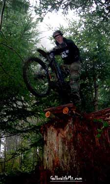
The alternative entrance to Lower Evolution is this rock face. The Freeride Fork and the main lower Evolution join part way down the rock face... |
 |
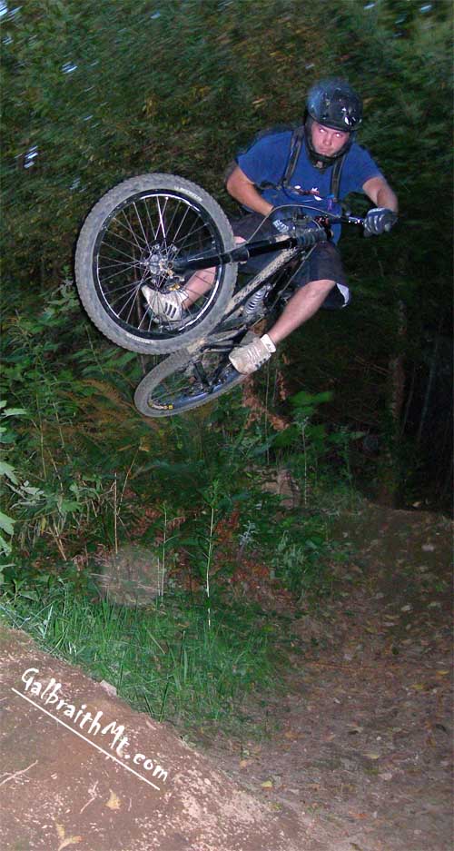
Lower Evolution is one jump infested section of trail. Here's a video clip of Jdub, Kurt Denadel, Russ Barlow and Dan Waters... |
 |
Dusty pickin' up speed on Lower Evolution... |
 |
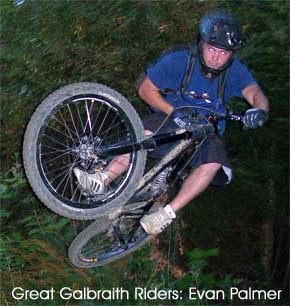
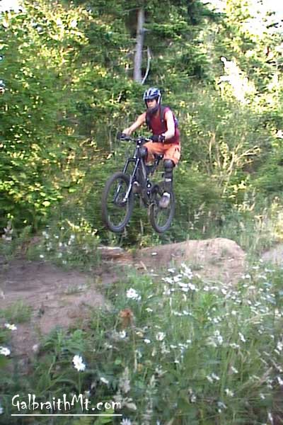
Evan Palmer flies like a panther a little further down Lower Evolution... |
 |
And here's the fly guy himself, Russ Barlow, going big on the step jump near the bottom of Evolution... |
|
Please read GalbraithMt.com's Terms of Use. © Copyright 2000-2010 by GalbraithMt.com. All rights reserved. BF Communications Inc. Website by Running Dog |
 |
|||
| Rides: 220 | Total vertical feet climbed: 404,900 | ||
Click here for GalbraithMt.com Map Set Index.
Click here for Driving Directions from Interstate 5 to Galbraith, plus MapQuest maps and live WebCam shots of Galbraith and the main freeway exits for Galbraith.