Click here for GalbraithMt.com's all new 2014 Smartphone Trail Maps...
|
||||||||||||
 |
 |
 |
 |
|||||||||
 |
 |
 |
 |
|||||||||

 |
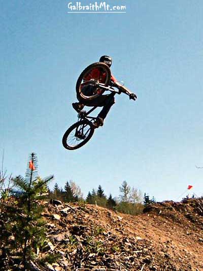 |
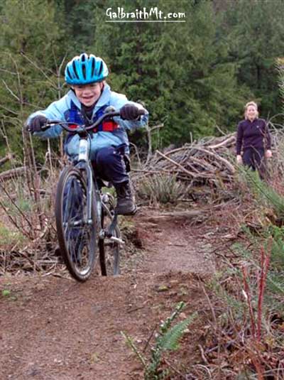
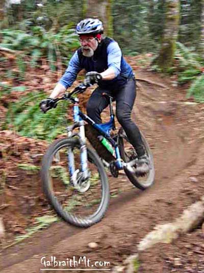
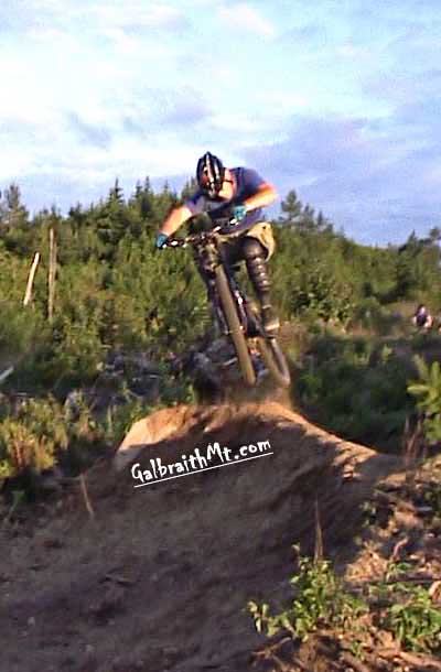
| Mark Adriance (ABOVE LEFT) swoops through the bermed turns in the upper portion of SST. Zack (ABOVE RIGHT) airs out one of the jumps in the lower section of SST (photo by Jdub), while Little Hucker get it on under the watchful eye of his mother (BELOW LEFT). Mongo rips the berms on The Runway (BELOW RIGHT). | |
 |
 |
SST, The Runway & The Old Up --
|
||||||||||||||||||||||||||||||||||||||||||||
| Trail name(s): | SST, The Runway & The Old Up (the newer SST runs within touching distance of the Old Up for a portion of their forested middle portion. The Runway is the new extension of SST that carries it all the way to Birch St. in the Hannah Creek development.) |
| Difficulty rating: | Flowing, frequently bermed singletrack with a number of tasty freeride stunts along the sides of SST, to say nothing of a full plate of technical trail riding -- big, steep rolling drops and stagger-step, off-camber root fests -- in the trail itself. You don't have to get big air to enjoy this trail, but you do have to be a good technical trail rider. The Runway is a little more extreme. The Old Up is a mellow forested climb that still provides a useful route to Arsenio, as it has since the '90s. |
| Elevation gain/loss: | 800 feet |
| Best riding direction: | SST and The Runway are best ridden down, but the Old Up is a tasty and quick climb to the north side of Arsenio, which you can connect with anything on the mountain. |
| Best seasons: | Gets heavy use all year long |
| Videos: |
Bob Torsett, Russ Barlow and company flying through the jumps on lower SST. Mongo climbing The Old Up. Mongo and Mark Adriance comin' down The Runway |
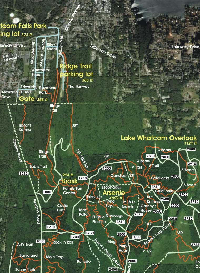
| Maps: |
See trail map at right. Click here for GalbraithMt.com Map Set Index. Click here for Driving Directions from Interstate 5 to Galbraith, plus MapQuest maps and live WebCam shots of Galbraith and the main freeway exits for Galbraith. |
IT HAS BEEN DELIGHTFUL to watch this premier North Side tech fest come into being.
Beginning in 2006, SST was extended further and further up (and down) the mountain. In 2010, it runs from its top near Arsenio at the junction with the Log Cabin Trail all the way down to it's the Power Line Right of Way, just east of where the Lower Ridge Trail hits the Power Line Right of Way, and then in 2009, below.
At first it paralled The Old Up. Then it paralleled the 1200 Rd., with several intermediate stops at temporary tops before crossing the 1200 Rd. and ultimately coming to its other end at the intersection with the Log Cabin Trail.
 Among the primary builders were Bob Torset (the legendary Galbraith trail builder who also created Bob's Trail, Cedar Dust, The Fire Ring, El Pollo Elastico and Mas Pollo, pictured at right on lower SST) and Doug Salisbury (who's brother Mark owns Fanatik Bike in Bellingham). They wanted a trail that would run from Arsenio all the way out in one long, uninterrupted run, and mostly "pointed down," as Doug put it.
SST has three distinct sections with three distinct flavors. The upper section parallels the road to the top of the Candies and is in the trees all the way. Here SST features some nice jumps and several tasy log and root drops, all with route arounds.
In the lower section, the trail emerges into a large, recent clearcut (the same clearcut that marks the bottom of the Old Up) and picks up speed for a series of rollers and hip jumps that are the delight of the Freeride crowd. Big air is available here for those who want it. Finally, at the very end, trail reverts to tighter singletrack with some sudden jukes and an exposed section of bedrock (which used to have cool roots crossing at odd angles until some idiot cut them out).
At present, the worst thing about SST is that the "official trail" dumps you out at the end on the old powerline right away. You turn left here to get back to the Lower Ridge Trail, but you have to ride through two bog holes to get there. Most people avoid the bogs by exiting before the end of SST on the road that connect to the middle Ridge Trail.
But there is another option: The Runway. After you climb out of the first bog, there is a trail that essentially extends SST down to Birch St. This is strictly a descending trail -- it's not meant to be climbed (too bad) -- with a lot of jumps and rolling pitches. By the summer of 2009, it was being ridden every day.
The following are some of the scenes from SST, starting at the top and rippin' to the bottom. Click on the thumbnail images to view a larger version...
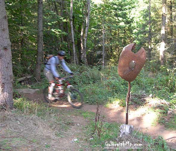 |
In pure Galbraithian fashion, the top of SST used to be marked by a rusty motorcycle gas tank mounted like a headhunter's trophy on a stick. This is where the top of the trail meets the road to the top of the Candies. It has since been extended to the junction with the Log Cabin Trail... |
 |
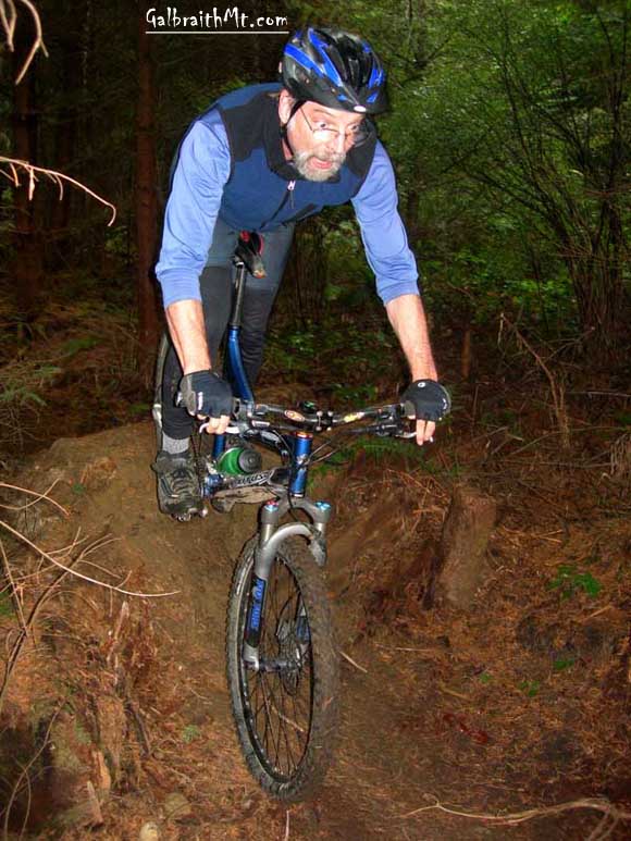
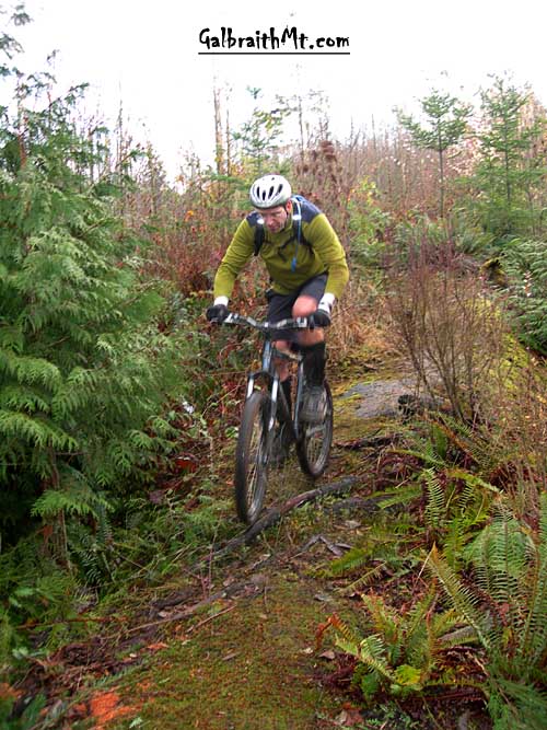
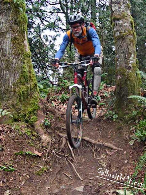
The first section of SST is a delightful and sometimes technical romp through the trees, but there are jumps along the way from the first 30 yards of the trail. Here's the Legendary David Waugh on the first, which features an obilesque-like rock in the middle of the trail ... |
 |
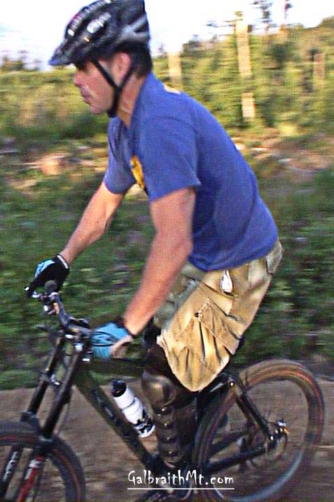
Here's Mark Adriance swooping through the bermed turns in the upper portion of SST. |
 |
There are a number of drops and jumps in the woodsy middle section of SST. |
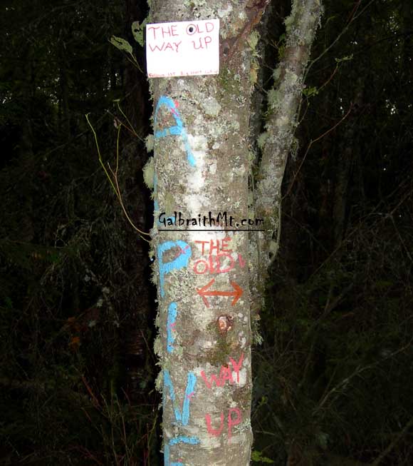 |
Meanwhile, SST runs parallel to The Old Up through part of the woods. The two trails are literally within touching distance at numerous points. This trail marker tree has "The Old Up" written on it several ways... |
|
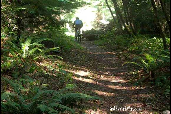
Here's Mongo climbing The Old Up. Sweet. Click here for video... |
 |
The top of the The Old Up, where it intersects with the 1240 Rd. |
 |
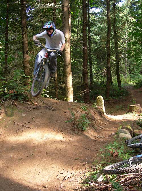
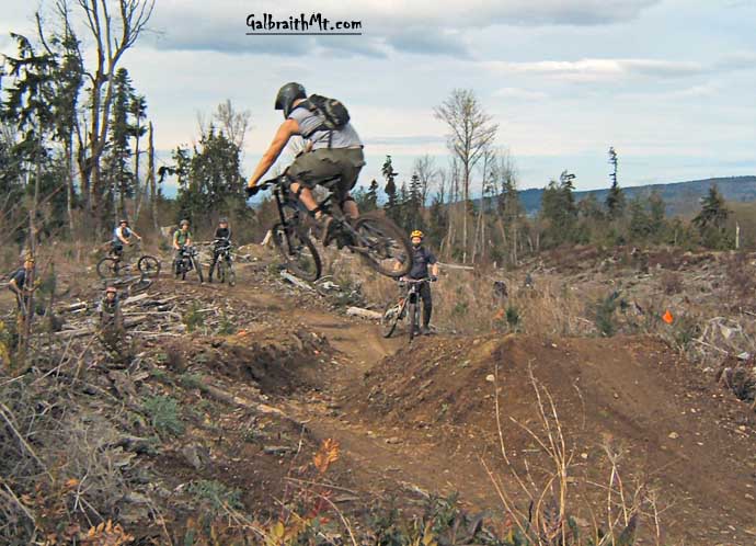
On SST, the real jump fest begins once the trail comes out of the woods into the clearcut at the bottom. Here's Zach X-up in the clearcut (photo by Jdub)... |
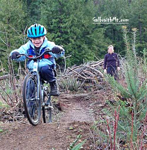 |
Little Hucker rocks out on SST under the watchful eye of his mother, Motherhucker, on the flats after the trail comes out into the clearcut (photo by Rebekah Keene)... |
 |
And here's Bob Torset, who built a lot of SST... |
 |
Jumping in the trail's mid-section before it was completed... |
 |
Easy to see why Bob's nickname is Moto Bob... |
|
Here it is ladies -- a close up of Big Bob, who's thinking, "What's next?" |
 |
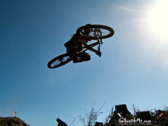
Well, here's what's next! Here's GORGANZOLA getting air before an appreciative audience... |
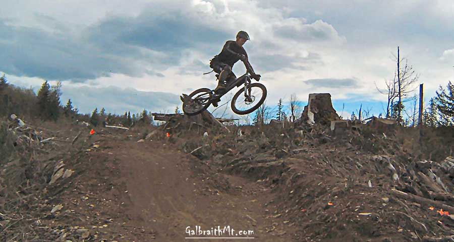 |
And Russ Barlow spreading his wings off the same jump... |
 |
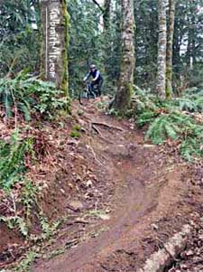
Finally, here's BigHoss near the bottom of SST, on the rooty rock just before the trail connects to the old powerline right away. The roots have since been cut away (NOT a trail improvement) |
 |
The entrance to the top of The Runway, off the Powerline right-of-way that also bisects the Ridge Trail and marks the bottom of SST "proper." |
 |
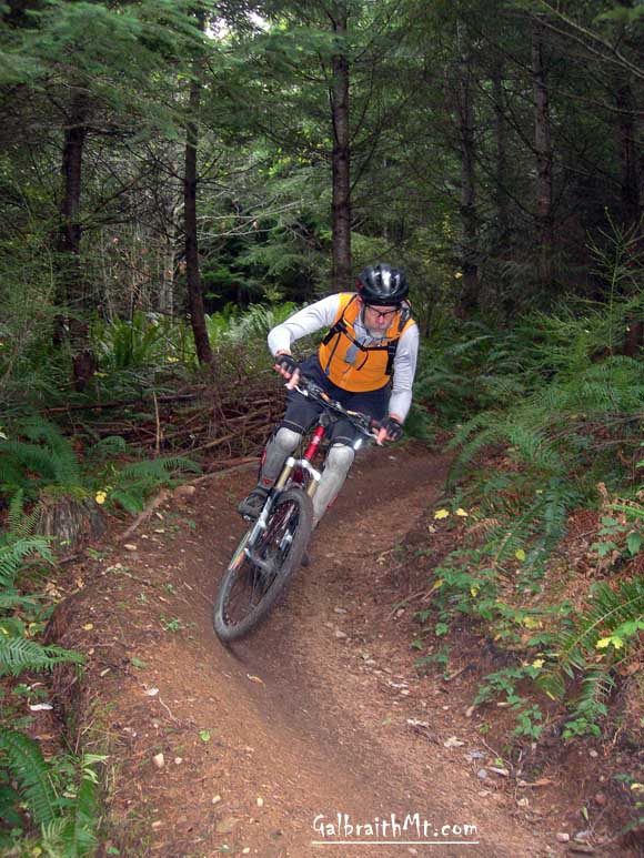
Mongo near the top of The Runway, where there are a series of steep pitches with ultra-sweet, bermed run-outs... |
 |
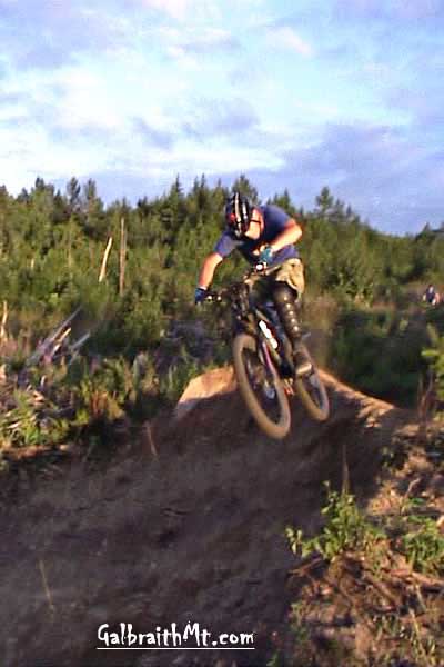
Mark Adriance just goin' off the lip of one of these deliciously rooty drops. Here's video. |
 |
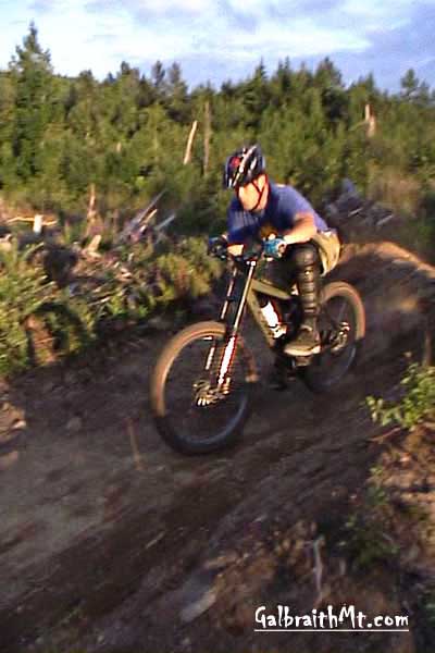
Mongo rippin' the berm below. Here's video. |
| Updated January 30, 2010 |
Click here for GalbraithMt.com Map Set Index.
Click here for Driving Directions from Interstate 5 to Galbraith, plus MapQuest maps and live WebCam shots of Galbraith and the main freeway exits for Galbraith.
|
Please read GalbraithMt.com's Terms of Use. © Copyright 2000-2010 by GalbraithMt.com. All rights reserved. BF Communications Inc. Website by Running Dog |
 |
|||
| Rides: 220 | Total vertical feet climbed: 404,900 | ||