
Click here for GalbraithMt.com's all new 2014 Smartphone Trail Maps...
|
||||||||||||
 |
 |
 |
 |
|||||||||
 |
 |
 |
 |
|||||||||

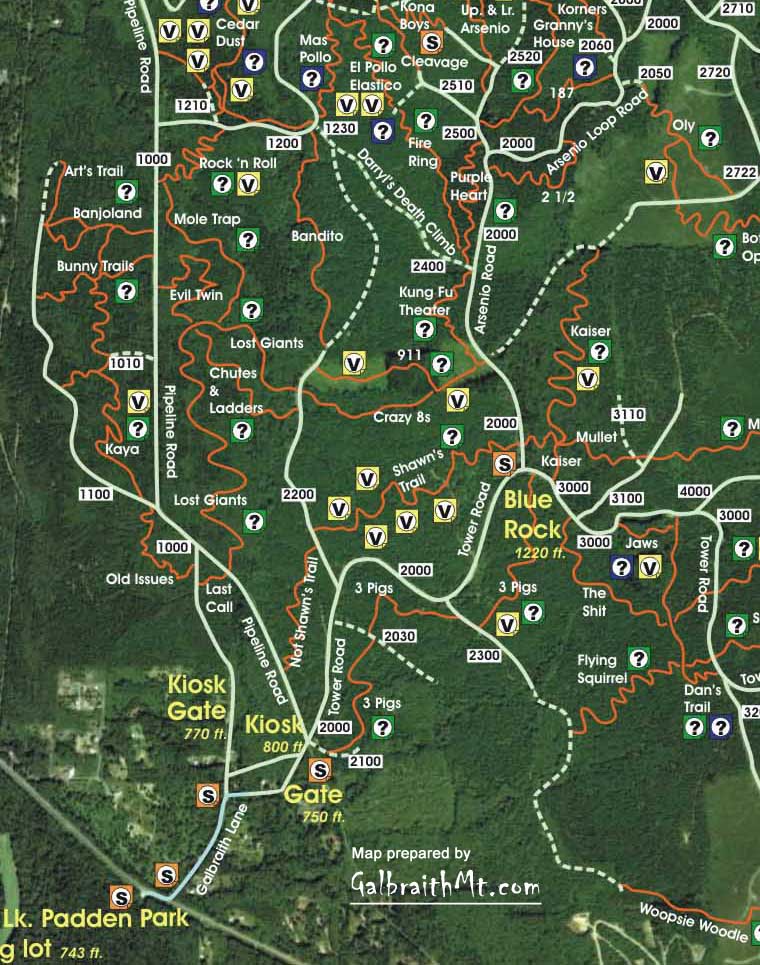
| The South Side's Best? Rock 'n Roll & Mole Trap
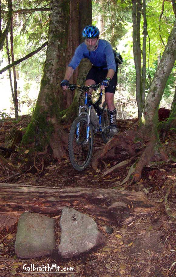
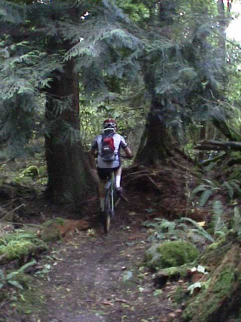
Mongo dropping into The Slime King on Rock 'n Roll, just off the Pipeline Rd. / 1000 Rd. aboard his personal Titus Switchblade. |
 |
 |
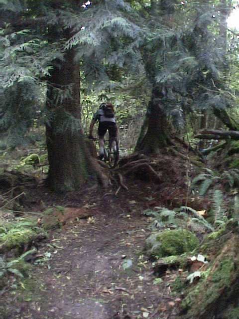
| Mark Belles (left) romping on Rock 'n Roll on his personal Kona Coiler, while Guano studies the entrance to Mole Trap off Rock 'n Roll, right by the huge downed old growth cedar near where Rock 'n Roll meets the Pipleline Rd. / 1000 Rd. | |
|
||||||||||||||||
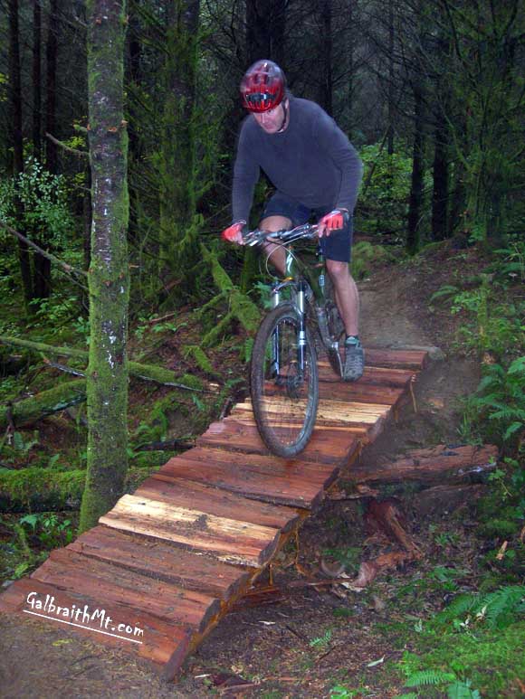
| SPEAKING PERSONALLY, this is my favorite South Side trail. Yea, Lost Giants, Evil Twin, Shawn's Trail and 911 are very sweet, but Rock 'n Roll -- AKA Polka Dot Trail -- is my number 1. Why? Well, I guess I'd have to say that it's the way the ingredients mix in the pot. Deep vine maple and hemlock woods; big old growth cedars lying scattered here and there in the shadows; a lot of swoopy use of the terrain spiced with the inevitable Galbraithian log roll overs, root punchups and an occasional slow, tight switchback or a low, slimy catwalk over a bog.
The best, though is at the very end or the very beginning, depending on which way you ride Rock 'n Roll (which was originally called Polka Dot Trail because it was flagged with polka dot flagging in 2003). On the southern most end, just where it leaves the Pipeline Rd. and starts into the trees, there is a cedar log / slab combo that is a real hoot. It's easiest if you start on this end because you have a little bit of downhill grade to work with, but it's not a piece of cake this way by any means. And ridden the other way, at the end of the whole Rock 'n Roll rip and climbing to boot, it's a challenging piece of technical trail riding.
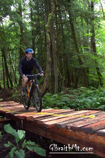
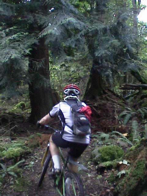
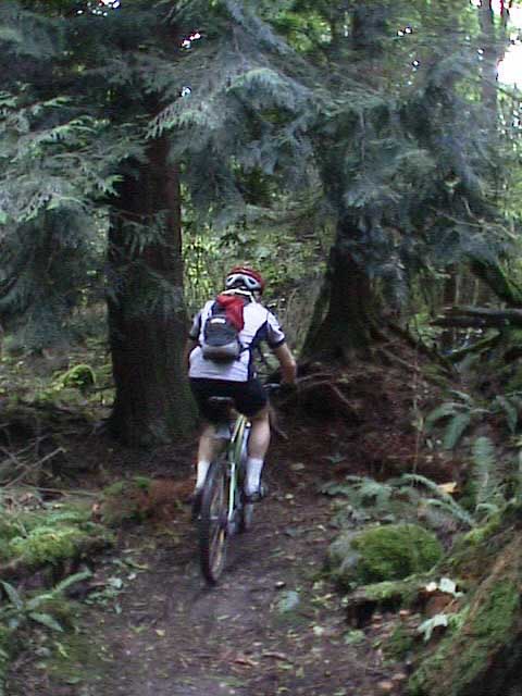
Apart from this consideration, the Rock 'n Roll rides just as well in either direction, and makes an excellent connector to get from the South Side to the North side when you hook it up with Cedar Dust. THEN IN THE FALL of 2009, master Galbraith trail builders Guano and Legendary David built a very useful new trail that connects Rock 'n Roll with Lost Giants, making it possible to ride singletrack (no roads!) almost all the way over Galbraith, from the South Side to the North Side, or vice versa. Called Mole Trap, this new trail laves Rock 'n Roll at the huge old growth cedar stump near where Rock 'n Roll meets the Pipeline Rd. / 1000 Rd. From there it heads south, paralelling the road as it skirts a swamp, and then break free to run snakey and unfettered to meet Lost Giants not too far from its junction with Evil Twin. Sweet! As of 2010, Mole Trap is still pretty raw in places -- the trail bed has yet to set -- but it promises to be a great compliment to the other standout cross country trails on the South Side. The following are some of the scenes from the trail. Click on the thumbnail images to view a larger version...
|
Click here for GalbraithMt.com Map Set Index. Click here for Driving Directions from Interstate 5 to Galbraith, plus MapQuest maps and live WebCam shots of Galbraith and the main freeway exits for Galbraith. |
|||||||||||||||
     |
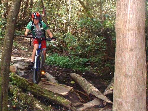
| One of the gnarliest parts of Rock 'n Roll is this root crown pinch near the Cedar Dust end of Rock 'n Roll. Steve Hindman is shown here riding it in 2004. In 2009 it was still there, and still challenging both ways (don't say we didn't warn you). Click here for video. |
|
Please read GalbraithMt.com's Terms of Use. © Copyright 2000-2010 by GalbraithMt.com. All rights reserved. BF Communications Inc. Website by Running Dog |
 |
|||
| Rides: 220 | Total vertical feet climbed: 404,900 | ||