Family Fun Center --
|
|||||||||||||||||||||||||||||||||||||||||||


|
|
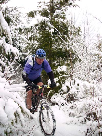
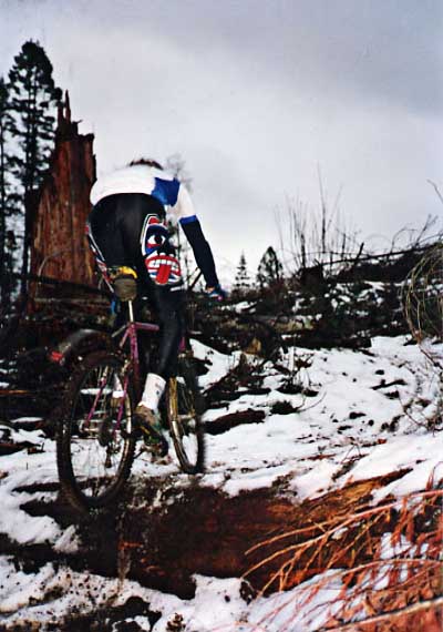
Russ Lambert AKA Guano riding the Family Fun Center bare legged in the snow in February. |
| Trail name: | Family Fun Center |
| Difficulty rating: | Easy with a few more difficult stunts scattered along the side of the trail. |
| Elevation gain/loss: | Negligible |
| Best riding direction: | Excellent in either direction; can also be looped on itself. |
| Best seasons: | Gets heavy use all year long. |
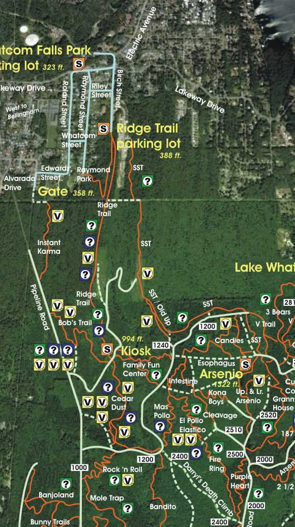
| Maps: |
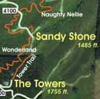
See trail map at right. Click here for GalbraithMt.com Map Set Index. Click here for Driving Directions from Interstate 5 to Galbraith, plus MapQuest maps and live WebCam shots of Galbraith and the main freeway exits for Galbraith. |
SWEET AND USEFUL is a good way to describe the Family Fun Center.
What we call the FFC is actually a couple of swoopy, semi-parallel trails that connect the Ridge Trail to the Log Bridge that marks the beginning of the Lower Intestine.
This trail is among the most heavily ridden on the mountain -- partly because of its strategic location connecting the Ridge Trail to the Arsenio area. But that's just part of it. The Fun Center have a high fun factor, with lots of chicane S's and a generally smooth, fast trail bed. Best of all, it can be enjoyed by a wide range of riders, from novice to expert. The only real problem with the trail is that -- like so many on Galbraith -- it is too short.
There are a few optional stunts along the side of the FFC, but you don't have to ride them. In fact, the only unavoidably technical moment occurs just before it comes down to the log bridge. Here you'll find a catwalk across a (generally) muddy moat protecting a log pile that you have to vault up onto and over. Big fun, Galbraith styl-eeee!
 THE FAMILY FUN CENTER has another fork too -- to the north of the main one, which has its terminus -- which allows the trail to be ridden as a loop itself. This was blocked off by the WHIMPs in 2006, but it has been reopenned and remains just about exactly the way it always was.
Oh yes, this trail definitely gets muddy in here in the winter (spring, summer, fall). The high traffic and the nature of the terrain conspire to produce a series of mud holes, none of which are terminally malignant.
The following are some of the scenes from the trail. Click on the thumbnail images to view a larger version...
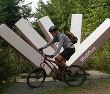 |
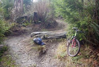
Here's the sculpture at the hub of the North Side where four trails meet: the top of the Family Fun Center, the Ridge Trail, Bob's Trail and Cedar Dust. Click here for more Galbraith art... | ||||||||||
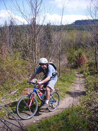 |
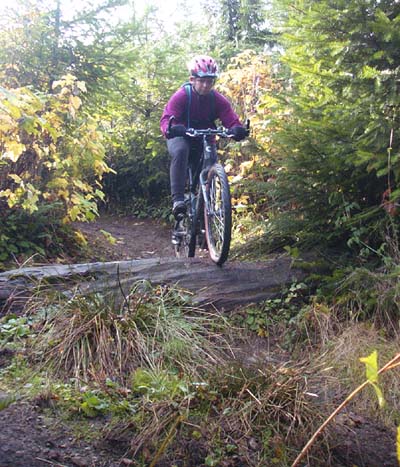
Tom de Barie on the upper fork on a sweet spring day, with Arsenio in the background... | ||||||||||
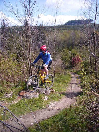 |
Mark Belles horsing around near the top of the upper fork, where it meets the top of the Ridge Trail, with Arsenio in the background... | ||||||||||
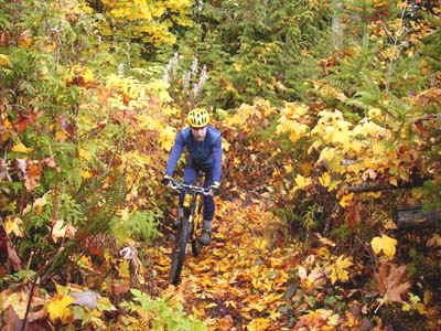 |
The lower fork in fall... | ||||||||||
 |
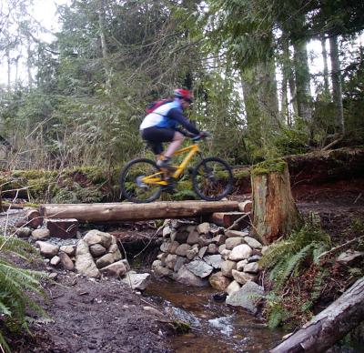
Here's Mark Peterson riding the lower fork -- the big cedar stump by the creek is in the background -- in the '90s, shortly after the area was logged. Cool shorts... | ||||||||||
 |
Here's Mark Belles crossing the log bridge. The trail was originally called the Belles Family Fun Center... | ||||||||||
|
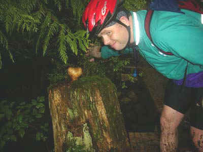
A carved wooden heart that adorned a stump beside the log bridge until someone trashed it... | ||||||||||
 |
An optional log drop on the lower fork... | ||||||||||
 |
and doin' it! | ||||||||||
 |
Here's Missy Belles riding the low bridge that Jim Fricker built over the FFC's perpetual mud hole during late 2004. Big improvement -- thanks Jim! | ||||||||||
|
|||||||||||

Click here for GalbraithMt.com Map Set Index.
Click here for Driving Directions from Interstate 5 to Galbraith, plus MapQuest maps and live WebCam shots of Galbraith and the main freeway exits for Galbraith.