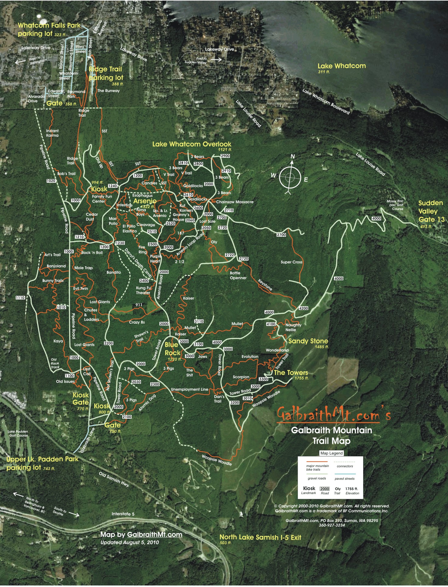
Maps August 26, 2010 --
New Galbraith Smartphone Maps!
GALBRAITHMT.COM'S COMPLETLY NEW satellite and GPS technology-based Galbraith Mt. Smartphone Trail Maps are here. These aren't low-res maps -- they're the same maps as our Regular Edition -- but they're optimized for speedy loading and small screens...
|
|
|
|
| Subscribers can click the links below to go directly to the Maps... |
| 1 |
 |
Big Naked Trail Map for Smartphone, which is great when you want to really see the entire mountain and all the trails -- naked, so to speak. |
|
|
|
| 2 |
 |
Big Bells & Whistles Trail Map for Smartphone, with hot links to all our Trail Guides, Technical Notes and Video Clips -- This IS "The Ultimate Galbraith Mt. Guide." |
|
|
|
|
|
NOTE: Because of the extensive logging on Galbraith over the last several years, these maps are no longer accurate. Most of the trails still exist, but many have different routes and connect in different places.
|